


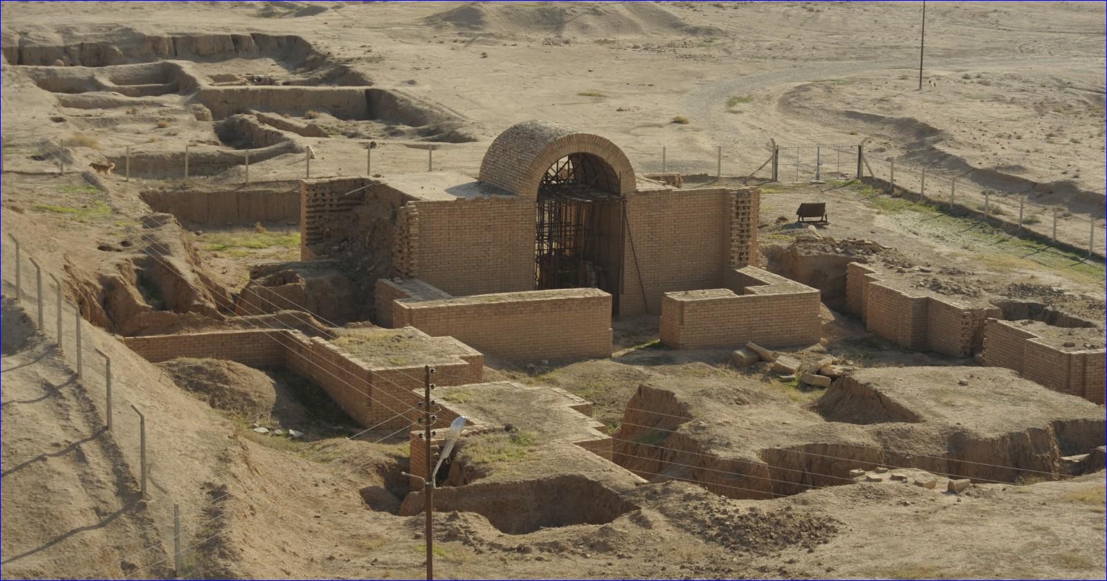
 Wikimedia Commons)
Around that mound lies a walled town of about 340 hectares, roughly the ground area of New York's Central Park. Apart from three buildings, it has been left alone for 180 years.
A project report in Antiquity by Daniele Morandi Bonacossi and Francesca Simi of the University of Udine sets out what its 2025 field season did with that ground. The project made a topographic map, walked the lower town on a grid, and ran a magnetometer across selected parts of it. The magnetometer returned organised street systems, domestic neighbourhoods and larger complexes.
Who the trenches were for Research at Nimrud has run in one direction. As the report puts it, work there since Layard has focused almost entirely on the acropolis, with its palaces, temples and monumental buildings and the artworks and inscriptions they held. The exceptions inside the lower town amount to Fort Shalmaneser, the Town Wall Palace and the palace in PD5. What was neglected with the rest of it, on the report's own list, is its fortifications, street system, residential neighbourhoods, public buildings, crafts and open spaces.
Nimrud, the Assyrian Kalhu, was the empire's seat from 879 to 707 BC, longer than any other Assyrian capital, and its lower town is enclosed by nearly 8 kilometres of fortification wall with monumental gates and towers.
One attempt was made to map the layout on the ground. Paolo Fiorina worked at it between 1987 and 1989, and the First Iraq War stopped him. The same imbalance shows up at Khorsabad and Nineveh, which the report says are only now beginning to be systematically explored in their entirety by international teams. Work has also resumed on those capitals' acropoleis, often through post-conflict programmes launched in response to the destruction caused by Islamic State.
So most of what is known about Assyrian capitals comes from royal architecture and royal art, which describe the king and the court. What the rest of the city looked like, and how the people who were not part of the court lived in it, has stayed thin.
What it takes to read a ploughed field Two things left the ground legible. Unlike other major Assyrian capitals, the report says, Nimrud was never intensively reoccupied after the Assyrian empire fell in 612 BC, and the lower town remains mostly untouched even today. The farming there now uses shallow ploughing, limited to approximately 0.2 metres, which the researchers say only partially affects the archaeological layers below.
The starting point was imagery nobody took for archaeology. The team analysed declassified photographs including the U2, CORONA and HEXAGON missions, which the report dates between 1967 and 1974. That imagery, the report says, suggested the lower town preserved a highly structured urban landscape, revealing details of the fortifications, city gates and a street system, along with zones of dense and sparse occupation and apparently open spaces.
Those observations were first drawn out by the archaeologist Jason Ur in a 2013 study of Neo-Assyrian city form, and the report says they pointed to the considerable potential of the lower town while also underscoring the need for ground verification.
The 2025 season began by fixing the site in modern coordinates. A differential GPS and drone survey established a new network of benchmarks and produced an orthophoto, a digital terrain model and a new site plan.
Then came the walking. Survey teams covered the lower town on a 40 by 40 metre grid, recording what lay on the surface of each unit into a geodatabase. That dataset, the report says, allowed the spatial distribution of settlement evidence and its chronological variation to be analysed at a scale and resolution not previously available at the site.
Read across the whole lower town, the surface material describes occupation running from the third millennium BC through to the Islamic period, meaning roughly the mid-seventh to twentieth centuries AD. Three phases stand out as intensive: Middle Assyrian, around the mid-fourteenth to eleventh centuries BC; Neo-Assyrian, around the tenth century BC to 612 BC; and post-Assyrian, from around 612 BC to the late fourth century BC. That last phase sits against the same report's statement that Nimrud was never intensively reoccupied after 612 BC, and the report does not reconcile the two.
The survey also turned up inscribed material, mostly baked bricks. Among it were fragments of five different prisms belonging to Sennacherib, who reigned from 704 to 681 BC, and Ashurbanipal, who reigned from 668 to 631 BC. Both kings ruled after Nimrud had ceased to be the imperial capital, on the report's own dates for the imperial seat.
Shapes without dates The last component was geophysical. Magnetometer survey was run in selected sectors of the lower town to test what the topography, the old imagery and the surface finds had suggested, and it revealed organised street systems, domestic neighbourhoods and larger complexes. The figure the report publishes shows preliminary results from a single sector east of the acropolis.
The figure is a map of contrasts in soil magnetism. Buried walls, streets and burnt features can be inferred from those contrasts. Their dates cannot. A magnetogram of one sector says a street ran there; it does not say when, or who lived on it, and the report offers no excavated check on either question. Pottery lying on the surface has the matching limit: it puts people in a period, without saying how many of them or what they lived in.
Some coverage of the project has already gone further than the report does. A summary in Archaeology credits the geophysical survey with confirming streets, neighbourhoods, large building complexes, walls, kilns and pits. The Antiquity text lists three: organised street systems, domestic neighbourhoods and larger complexes. Walls are fair enough: the report names the town's fortifications and gates in its own account of the imagery, and a street and a neighbourhood in a magnetogram are read off buried walls. Kilns and pits are another matter, and neither word appears anywhere in the report. The same summary also states that the lower town was home to most of the city's population, which is a reasonable expectation for a walled area of this size but not a claim the report makes or could yet support.
A canal that may be the wrong canal One early result reaches beyond the city wall. Nimrud's water is conventionally credited to the Patti-Hegalli canal, cut by Ashurnasirpal II, the king who founded the capital and reigned from 883 to 859 BC.
New topographic data associated with that canal, the report says, indicates that Nimrud's water management system may require substantial reappraisal. The report then adds a separate suggestion, which it does not say the data indicates: rather than the Patti-Hegalli, a more northerly canal system may have been Nimrud's principal water source. Both claims are hedged in the original, and the hedges are load-bearing. The report presents no excavated evidence bearing on the question.
That is the register of the whole document. It describes the state of the work as of summer 2025, and it appears in Antiquity's Project Gallery. Its own list of next steps, which it frames as further enriching the project's dataset, is more geophysics, geoarchaeological work, targeted soundings and open-area excavation.
Back to the mound Layard's trenches produced an Assyria of kings, and for 180 years that was the Assyria available. Reading the rest of the city at site-wide scale now looks possible, on the evidence of one grid, one drone, a magnetometer in sample sectors and photographs taken by spyplanes and spy satellites for entirely different reasons.
The 340 hectares he did not dig held the other Assyria, and the first map of it is a new site plan, a scatter of potsherds on a grid and a magnetogram of one sector east of the mound.
or register to post a comment.