


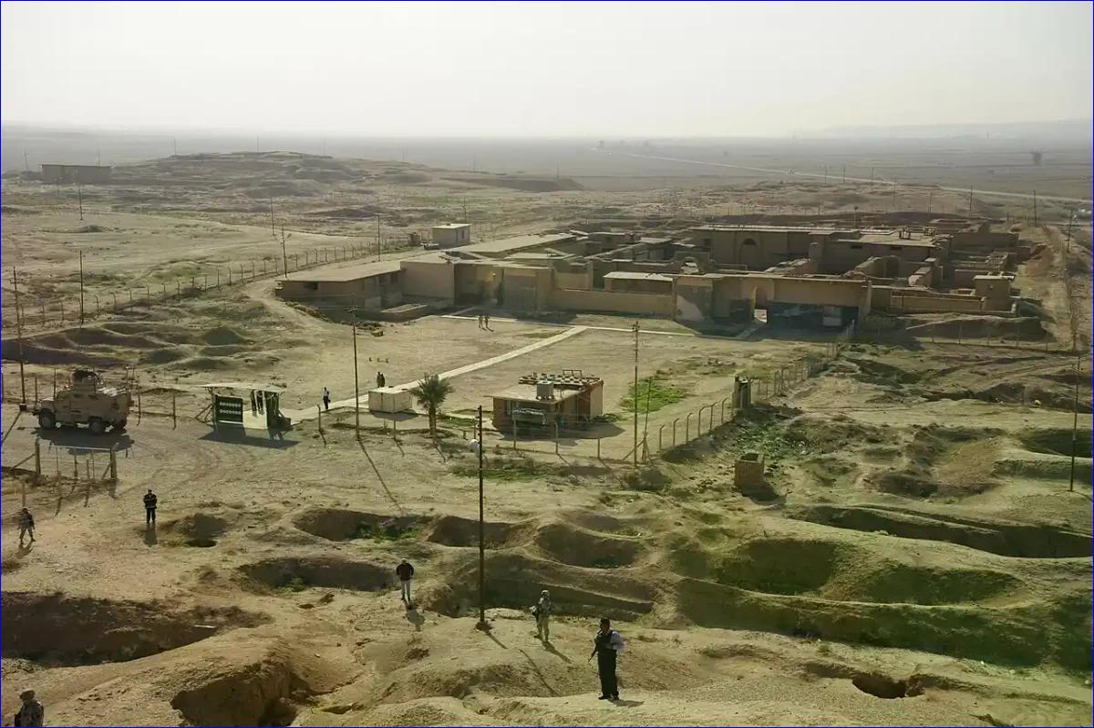
For nearly two centuries, archaeologists excavating Nimrud, one of the capitals of the Assyrian Empire in present-day northern Iraq, focused their attention on the acropolis mound. There, they unearthed palaces, temples, and massive stone reliefs depicting the deeds of kings.
But the city that spread at its feet--an extensive area of 340 hectares surrounded by walls nearly eight kilometers long--remained virtually unexplored. This neglect, which lasted for 180 years, has begun to be addressed thanks to the Nimrud Lower Town Archaeological Project (NiLTAP), a team from the University of Udine that has presented the first results of its campaign.
The project, led by archaeologists Daniele Morandi Bonacossi and Francesca Simi, has applied a comprehensive approach that combines cutting-edge technology with classical survey methods. The goal is to reconstruct the daily life of the common inhabitants of the Assyrian capital, not just that of the royal elite.
To this end, the team produced a high-resolution topographic map of the entire site, conducted a systematic surface walk collecting thousands of pottery fragments, and used magnetometers to detect buried structures without the need for excavation.
A Knowledge Gap of Nearly Two Centuries
Nimrud, known in antiquity as Kalhu, was founded as an imperial capital by King Ashurnasirpal II in 879 B.C. and maintained that status until 707 B.C., when the court moved to Dur-Sharrukin (modern Khorsabad).
Despite its importance, excavations since 1845, when Austen Henry Layard began work, concentrated on the palaces and temples of the acropolis. The lower city, where artisans, merchants, and the rest of the population lived, was only the subject of an attempted study between 1987 and 1989 by archaeologist Paolo Fiorina, but the Gulf War interrupted that work.
Due to the way investigations were carried out in the main urban centers of the central Assyrian region in northern Iraq, our knowledge of Assyrian cities remains limited, the project authors explain in their article. This imbalance is not unique to Nimrud; it also affects the other capitals, Nineveh and Khorsabad, although in recent years international teams have begun to explore them in their entirety.
The lower city of Nimrud, however, offers a unique opportunity. Unlike other capitals, it was not heavily reoccupied after the fall of the Assyrian Empire in 612 B.C. Today, the area is used for shallow cultivation, disturbing only about 20 centimeters of soil, so the archaeological remains remain largely intact. In addition, its long period as an imperial seat--nearly two centuries--allows researchers to study the evolution and decline of a capital city over time.
 C. Miele & A. Persichetti of Archetipo/F. Simi/NiLTAP)
Cutting-Edge Technology for an Ancient City
The NiLTAP team began its work by analyzing declassified satellite images, including missions from 1967 to 1974, such as U2 spy planes or CORONA and HEXAGON satellites. These images already suggested that the lower city preserved a highly structured urban layout, with walls, gates, streets, and areas of denser or lighter occupation. But confirmation on the ground was needed.
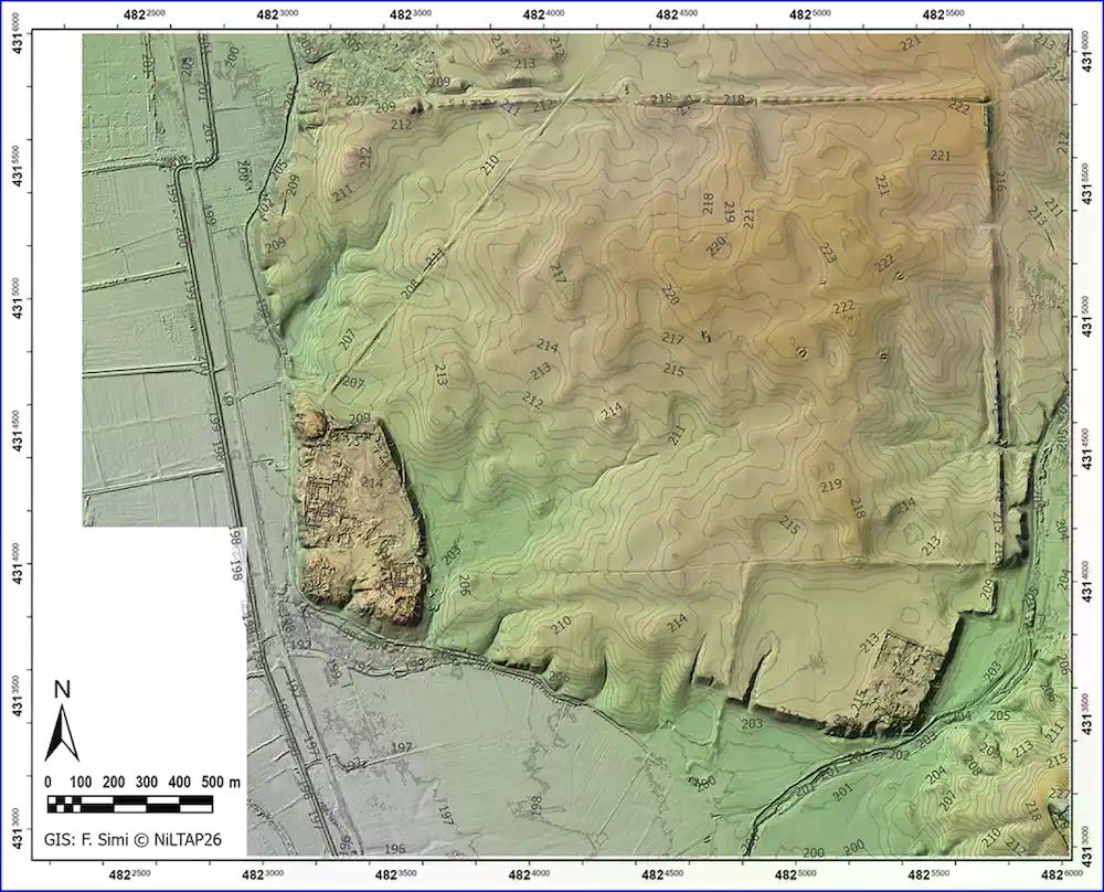
During the 2025 campaign, archaeologists generated for the first time a modern topographic map of the entire site. To do this, they used a differential global positioning system (DGPS) and a drone, which provided an orthophoto (a geometrically corrected image) and a digital terrain model. This new plan served as the basis for all subsequent activities.
Next, they conducted an intensive walkover survey. They divided the lower city into a grid of 40-by-40-meter squares, and in each one collected all visible pottery fragments from the surface. The result was a density map of materials covering the entire city--something never before achieved at this scale.
The data, stored in a geographic database, allow for the analysis of settlement distribution and its chronological evolution from the third millennium B.C. to the Islamic period (mid-17th to 20th centuries A.D.).
The results show that the occupation was particularly intense during the Middle Assyrian period (mid-14th to 11th century B.C.), the Neo-Assyrian period (10th century B.C. to 612 B.C.), and the Post-Assyrian period (612 B.C. to the late 4th century B.C.).
In addition, the researchers recovered several epigraphic materials, mainly baked bricks with inscriptions, including fragments of five different prisms belonging to the Assyrian kings Sennacherib (who reigned from 704 to 681 B.C.) and Ashurbanipal (668-631 B.C.).
Reinterpreting the Hydraulic System and New Underground Discoveries
The combination of new topographic data with historical images has made it possible to revise previous hypotheses about the urban layout. For example, one of the most significant discoveries relates to the water supply system.
Until now, it was believed that the Patti-Hegalli canal, built by the city's founder, Ashurnasirpal II, was Nimrud's main water source. However, new observations suggest that it may have been a more northern canal that actually supplied the city. The new topographic data associated with the Patti-Hegalli canal indicate that Nimrud's water management system may require substantial reevaluation, the authors note.
The final component of the integrated approach was geophysical survey. In selected sectors of the lower city, archaeologists conducted magnetometry, a technique that measures variations in the subsurface magnetic field to detect walls, kilns, pits, or any buried structures without excavation. This method provides an image of the buried urban fabric.
The first results, corresponding to a sector east of the acropolis, have already revealed an organized system of streets, residential neighborhoods, and larger complexes. Magnetometry was conducted in selected sectors of the lower city to test key topographic and survey observations, revealing organized street systems, domestic neighborhoods, and larger complexes, and providing a link between surface evidence and the buried urban fabric, the researchers explain.
These magnetic images confirm that the current surface, with its cultivated fields, is only the tip of the iceberg of a planned city still waiting underground.
owards a New Vision of the Assyrian Capitals
The results presented by NiLTAP demonstrate that it is possible to investigate the complete urban structure of an Assyrian capital without limiting oneself to the royal palaces. The combination of surface survey, precision topography, analysis of historical imagery, and magnetic sensors--all integrated into a geographic information system--provides an unprecedented picture of how life was organized in an imperial city.
The results presented here demonstrate the interpretive potential of an integrated methodological framework for the study of Assyrian urbanism and for advancing research on Assyrian capitals beyond the acropolis, the article concludes. And they add: By combining survey, topographic analysis, remote sensing, and geophysical prospection within a unified spatial framework, it is possible to investigate the urban fabric of an Assyrian capital at the scale of the entire site.
In future campaigns, the team plans to expand geophysical surveying to more sectors, conduct targeted archaeological soundings, and open extensive excavation areas to verify the interpretations obtained with non-invasive methods.
In doing so, they hope to complete the map of daily life in Nimrud, a city that for nearly two centuries was the political heart of the most powerful empire of the ancient Near East, yet whose anonymous population remained invisible to archaeology until now.
Source: Morandi Bonacossi D, Simi F. New approaches to Assyrian capitals: the Nimrud Lower Town Archaeological Project. Antiquity. Published online 2026:1-8.
or register to post a comment.